Drone Roof Inspection in Murfreesboro, TN
Use drone imaging to review large or hard-to-access commercial roofs in Murfreesboro. We connect aerial views to roof sections and hands-on findings.
Drone Roof Inspection
A large roof can take time to map before anyone climbs a ladder. Drone imaging gives an aerial view of field seams, rooftop equipment, drainage patterns, and visible storm debris across a broad section. It does not show what is under the membrane. We connect the images to a roof plan, mark areas that need closer access, and use a hands-on walk or test cut to confirm conditions before repair or replacement is priced.

Capture the Roof in a Useful Pattern
We set the flight path to cover roof sections in a repeatable order, with overlap at edges, curbs, and transitions. The image set should make it possible to identify a drain, seam, rooftop unit, or prior repair later. We confirm that the property allows flight and establish a safe launch area before the inspection. Weather, wind, airspace restrictions, roof access, and nearby operations can affect whether imaging is appropriate on the scheduled day.
Murfreesboro’s land-use update describes office and industrial settings, including warehousing, shipping, and manufacturing. Large roof areas and active sites can benefit from an aerial overview when lift access is constrained, but a plan category does not tell us the size or condition of any individual building. We check the actual roof geometry and operating limits first. A broad Veterans Parkway business-park roof may need staged imaging around tenant activity; the capture should identify each section without exposing private work areas unnecessarily. Before launch, we agree on who will receive the images and which roof labels are used in maintenance records. A facility manager can then match an observation to a work order, rather than guessing from a wide view. Images of tenants or interior activity are not part of the roof record.
Review Visible Conditions
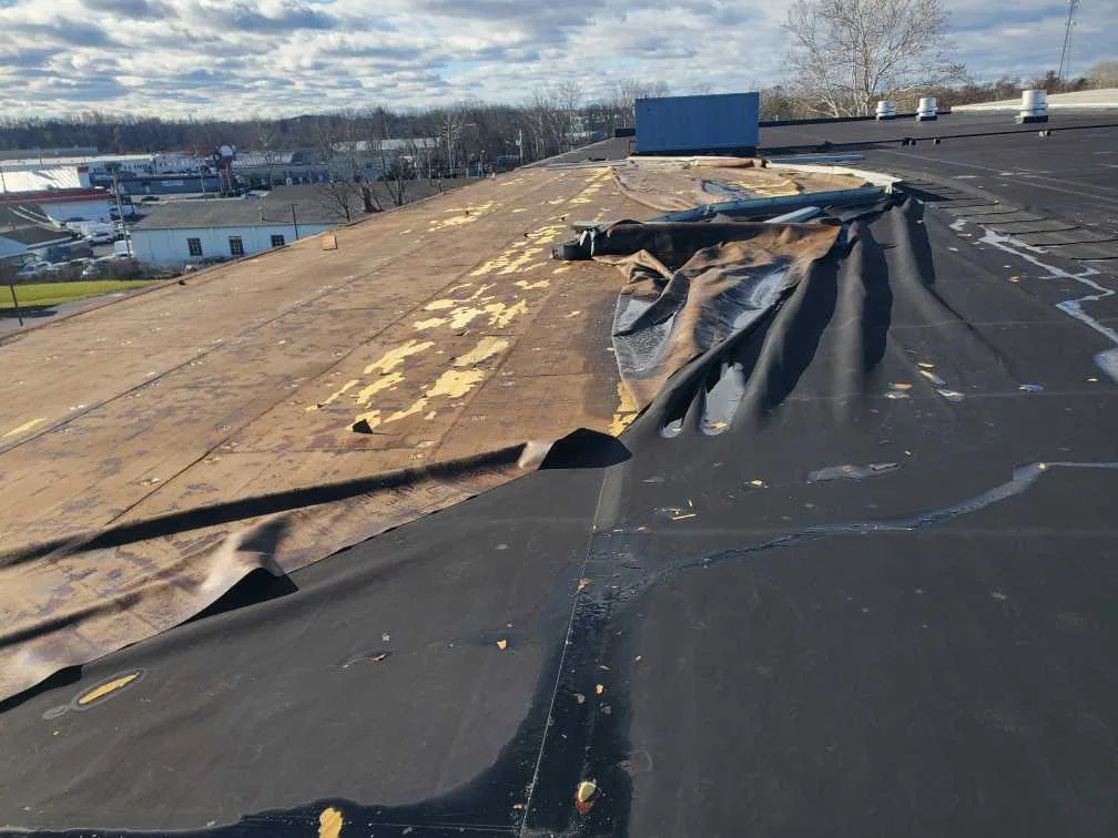
Images can help locate ponding, debris, displaced equipment covers, open penetrations, or areas where a previous patch changes the surface. We compare frames with the roof plan and label the section, not merely a compass direction. If a seam or curb is too small to inspect clearly, we record the limit and schedule safe access for a closer view. Aerial photos support a roof assessment; they do not establish adhesion, deck condition, insulation moisture, or hidden damage.
After a hail report, the image set can help prioritize a hands-on inspection of exposed areas. The National Weather Service logged hail near Murfreesboro in 2024, but the event record does not show whether a given roof was struck. We look for visible marks and displacement, then compare with earlier photos or inspect the surface directly. For a storm-related review, pair the imaging with storm damage documentation and a hands-on roof walk before approving a repair.
To make the images useful for a future comparison, we retain consistent section labels and record when shadows, glare, or surface water limit the view. Equipment banks can hide membrane details, and a low flight angle can make a curb appear open when the flashing is intact. We do not mark a repair from a single ambiguous frame. The field lead checks the relevant location and records what was confirmed before the owner receives an estimate.
Choose the Next Inspection Method
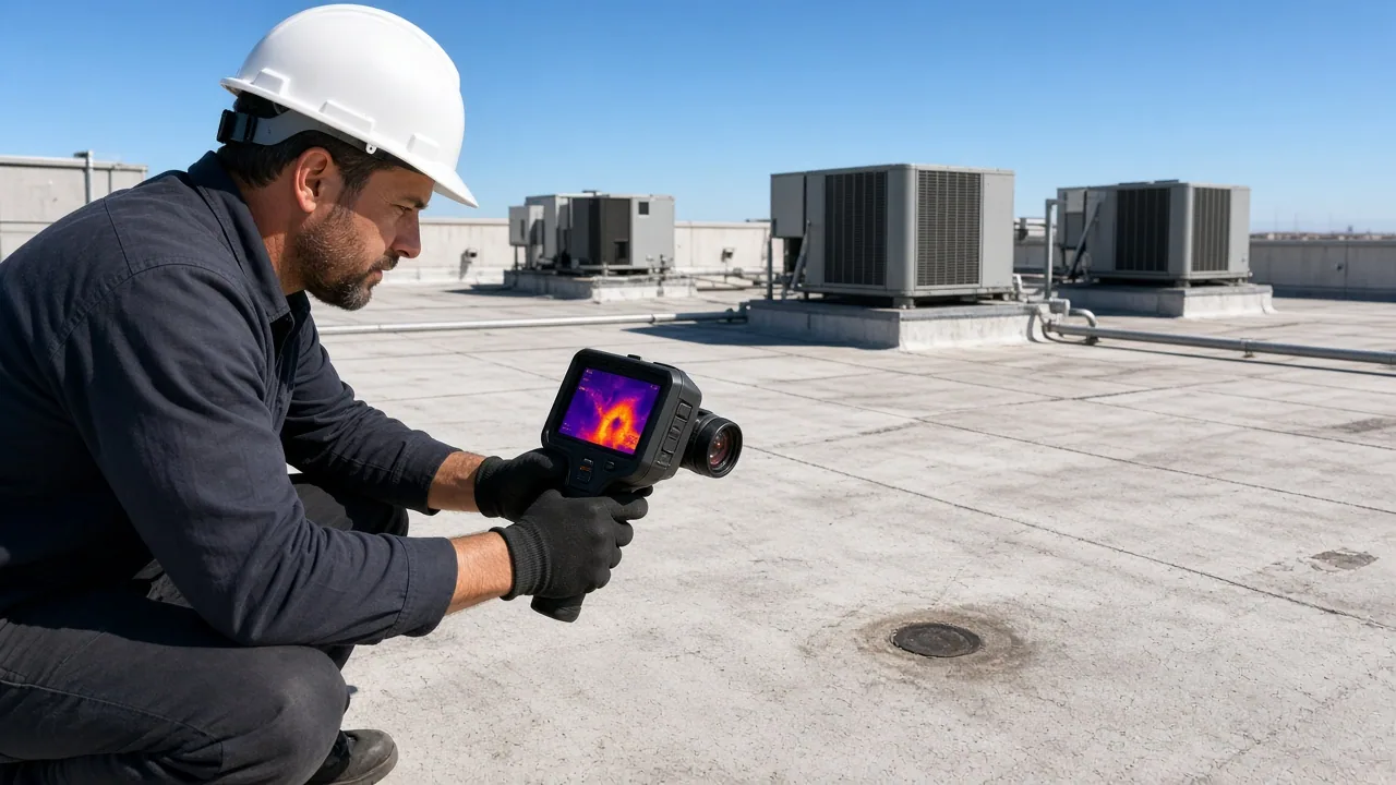
Aerial imaging works best when it answers a defined question. A remote overview can map the roof and identify suspect details, while a technician on the roof can test a seam, probe a soft area, check a drain bowl, or examine a flashing lap. Infrared equipment may add a temperature map, but a core or cut confirms suspected moisture. We identify the method used in the report so the owner knows which conditions were seen and which remain untested.
The inspection can be especially useful where roof access involves multiple wings or equipment zones. A commercial property near the Medical Center Parkway corridor might need aerial images first to coordinate an office access window; a warehouse near I-24 may require a landing zone away from delivery traffic. The infrared survey and condition report answer different questions. We select the follow-up based on visible findings and the owner’s decision.
Label Images by Roof Section
Each image needs a location key. We label roof sections, orientation, date, and visible detail, then preserve the original image files with the inspection records. A screenshot without a section reference is difficult to compare later. The report can call out drain groups, curb clusters, edge conditions, and areas hidden by equipment. If the property manager has prior aerial or roof-plan information, we align labels where practical and record any mismatch in the current layout.
Murfreesboro records frequent measurable rainfall, warm summer days, and repeated freeze nights. An image baseline can help locate areas where debris or ponding appears after weather changes, but it is not a substitute for checking flow at the drain. We document any standing water seen during the flight and return for a surface inspection when needed. The drain and overflow review can verify outlet condition, while photo records keep the findings tied to maintenance or capital work orders.
Turn the Image Set into a Roof Decision
The final report separates visible issues from questions that require roof access. A marked image may lead to a seam repair, a curb inspection, or test cuts in a suspected wet area. We give each item a location and next action, then price only work supported by the follow-up inspection. If replacement is under consideration, the aerial map can help divide the roof into sections and plan material staging, but deck and moisture conditions still govern the scope.
At properties near downtown Murfreesboro or along arterial roads, flight and staging permissions may differ from those at a private industrial site. We confirm property and airspace requirements before scheduling and keep the work inside authorized boundaries. If a roof cannot be captured safely because of wind or nearby activity, we reschedule or use a ground-based inspection method. The owner receives the images, observations, unresolved checks, and the proposed roof walk or repair sequence. Each finding is labeled by roof section and matched to the person who can approve follow-up access. We can return to the same frame locations on a later visit for comparison after repairs, seasonal checks, or a reported storm.
Commercial Roofing Questions
Can drone photos show wet insulation?
No. Aerial images show the surface and roof layout, not concealed moisture. An infrared scan can help prioritize suspect areas, and a test cut or core confirms the insulation and deck condition.
Do we still need a roofer to walk the roof?
When a seam, curb, drain, or soft area needs hands-on review, yes. Drone imaging can map visible conditions and guide that walk, but it does not test adhesion or hidden layers.
Can you fly over an active warehouse?
We first confirm property permission, airspace requirements, weather, and a safe operating area. The flight path and timing are coordinated around loading and yard movement. If the site cannot be captured safely, we use another inspection approach.
What does the image report include?
We label dated images by roof section and identify visible conditions, areas hidden from view, and the follow-up needed. The report links each observation to a location rather than leaving the owner with an unmarked photo set.
Will a drone inspection provide a replacement price?
It can support a roof map and preliminary review, but a replacement scope needs assembly, moisture, deck, edge, and access checks. We complete those inspections before pricing removal or a recover.
Related Roofing Work
More commercial roofing work connected to Drone Roof Inspection in Murfreesboro.

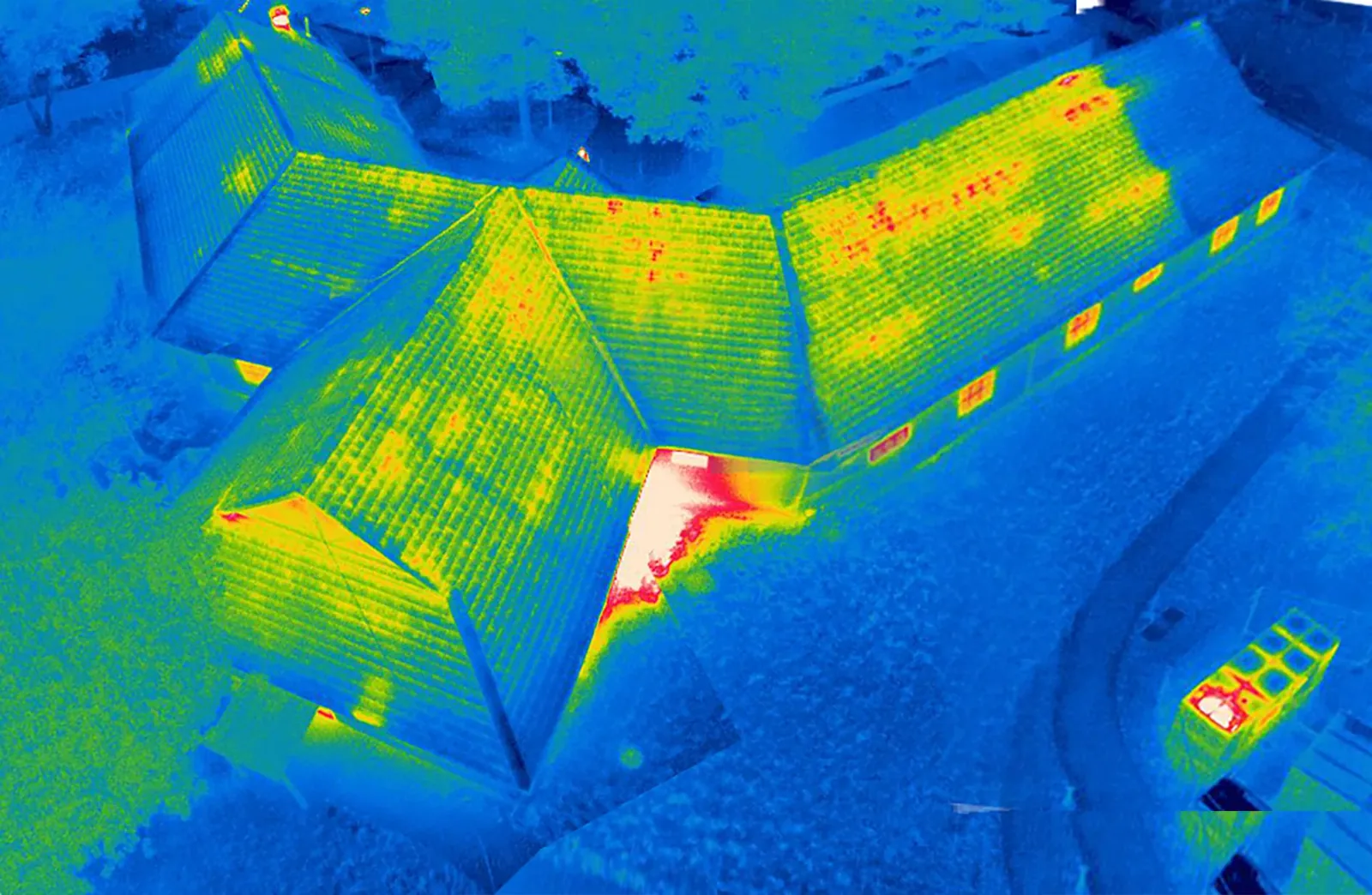

Map the Roof Before the Walk
Share the roof plan, access limits, and the decision the images need to support. We will confirm flight permissions, capture the roof by section, and identify any hands-on checks needed next.